Manufacturer: Garmin
What is the Garmin eTrex Touch 25?
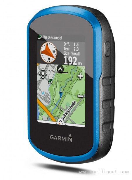
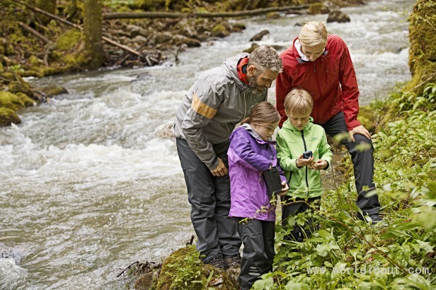
The Garmin eTrex Touch 25 is an outdoor GPS device aimed at families who like to partake in hiking and other such outdoor activities. This rugged device is also aimed at leisure cyclists, and has a fishing function too. onboard you'll find a full-colour touchscreen, preloaded maps, and the facility to add optional and custom maps. Could this be the hiking GPS that gets you and your loved ones out and about in the wild?
Garmin eTrex Touch 25 – Specification and Bundle
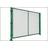
Garmin's hiking GPS units tend to be quite serious in design, but thankfully, the eTrex Touch 25 departs from this norm a little. It remains sturdily built, with an IPX7 water rating, which means it can withstand submersion in up to 1m of water for up to 30 minutes. However, Garmin has added a light-blue border around the screen fascia and the battery compartment at the rear for the device. Colourful silicone outer casings are also available as an optional extra.
The battery compartment cover uses a screw-locking system to ensure a tight seal. The mini-USB port is protected by only a rubber bung, but that shouldn't allow water into the device interior. The battery compartment takes a pair of AA batteries, which aren't included. It's also worth noting that although the USB port will power the device, it doesn't recharge any installed batteries. This will have to be performed via an external charger.
image: http://img.tradeleo.com/img/201512/15/164413304.jpg
Hidden beneath the batteries is a slot for a microSD card, which can be used to install extra maps and content. However, the eTrex Touch 25 already comes with 8GB of memory on board, which is preloaded with the Garmin TopoActive map of Europe.
This covers 46 countries, and is accompanied by a preloaded database of 250,000 Geocaches, of which more a bit later. There's also a world basemap, and demos of the BirdsEye Select and Digital Globe maps for detailed OS mapping and satellite imagery.
To add further maps, use Garmin's basecamp software, but only for a desktop. Both MacOS and Windows versions are available, however. This also lets you save out tracks and waypoints from the device.
There's no Bluetooth or Wi-Fi, however – only USB, so the smartphone version of basecamp won't be an option. You can also use the USB connection with Garmin Express to update the device firmware.
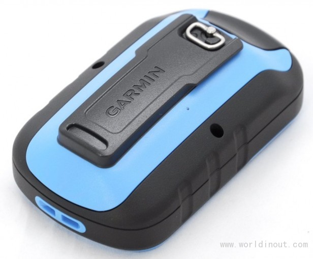
image: http://img.tradeleo.com/img/201512/15/164413974.jpg
Also in the box is a handlebar mount and some cable ties to bind it firmly onto your bike. The eTrex Touch 25 slides into this securely, but can be removed again relatively easily. However, you'll probably have to cut the cable ties to remove the mount. Garmin supplies enough in the box for a couple of refixings, but they're a standard size and should be readily available if replacements are required.
Garmin eTrex Touch 25 – Screen and Interface
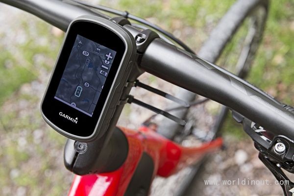
Operating the eTrex Touch 25 is exclusively performed via the 2.6-inch touch screen, which is a new addition to the eTrex range with this generation of devices. It's not particularly high resolution compared to current smartphones, offering just 160 x 240 pixels, but this is more than adequate for the intended usage.
The display has reasonably good viewing angles, but is quite glossy. As a result, in bright conditions care needs to be taken to angle the device so that reflections don't mar the visibility of the screen contents.
image: http://img.tradeleo.com/img/201512/15/164413324.jpg
Garmin has created a relatively user-friendly interface. The main menu provides screens you can swipe between for each of the default functions, which include Hiking, three types of Biking, Hunting, Fishing, Climbing and Geocaching.
It's also possible to switch to Classic Mode, which presents an interface like Garmin's earlier outdoor GPS devices, although switching back to the new interface from Classic Mode is a little annoying – you have to use a short press on the power button to regain the settings, which otherwise aren't so easily accessible.
The eTrex Touch 25 will remember how each of these profiles is set up, so your preferences for each of these activities will be called up automatically when you load the profile. You can associate a data dashboard overlay with a profile, alongside various system, screen, and map settings. You can also add or subtract data screens for a profile.
image: http://img.tradeleo.com/img/201512/15/164413104.jpg
By default, there's a map, a compass with data, and a trip computer display – but it's possible to add a view of satellite reception and remote control for a VIRB action camera. The latter is an odd inclusion, though: the eTrex Touch 25 doesn't have the requisite ANT+ connection (this is reserved for the 35 model), so can't actually connect to a VIRB wirelessly.
Garmin eTrex Touch 25 – Navigation and Geocaching
One of the main profile differences is the navigation type. There are lots of options here, from direct as-the-crow-flies navigation, to automobile, motorcycle, three types of bicycle, pedestrian road walking, hiking, mountaineering, off-road driving, or an option to prompt the user each time.
This makes the eTrex Touch 25 very flexible, allowing it to be optimised for the current use. It could even stand in for a vehicle sat-nav at a pinch, with turn-by-turn directions also available.
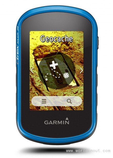
The Geocaching option presents an extra function on the screen, where you can see a list of nearby caches and search by name, or apply a variety of icon-driven filters.
Geocaching is a kind of GPS-enabled global treasure hunt, which I covered in detail some years ago. It's a fun activity, particularly for families with kids who enjoy outdoor pursuits. once you have chosen a cache, the eTrex Touch 25 will show the direction on the map towards it, or you can click through to read the description, user logs, any hints, plus the ability to adjust the coordinates. There's support for Garmin's Geocache-orientated "chirp" wireless devices too.
image: http://img.tradeleo.com/img/201512/15/164413644.jpg
Like many of Garmin's recent navigation devices, such as the Epix, the eTrex Touch 25 supports the Russian GLonASS satellite positioning system as well as American GPS. There's also support for WAAS (in the US) and EGNOS (in Europe), which improve accuracy from the usual 3-15m of GPS to under 3m.
The downside of turning on all these functions is the additional power consumption. Garmin claims up to 16 hours use on one set of batteries, although from my experience this would require top-quality alkaline batteries; my test NiMH cells weren't able to deliver anything near this during my review.
Should I buy the Garmin Garmin eTrex Touch 25?
The Garmin eTrex Touch 25 may not bring any particularly revolutionary new features to the table, but it does sport the latest GPS technology, and a lot of outdoor navigation ability for the money. With a street price only slightly more than £150, this is a lot of GPS for your money.
Garmin's aim was to make an outdoor activity sat-nav that's both user-friendly and affordable for families, and this has been achieved in spades.
Verdict
The Garmin eTrex Touch 25 has all the main features, a friendly interface, and a keen price for family outdoor GPS fun.